|
Many thanks for permission to use graphics from their software and toposheets |
|
|
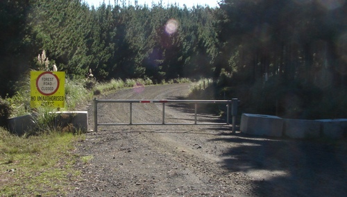
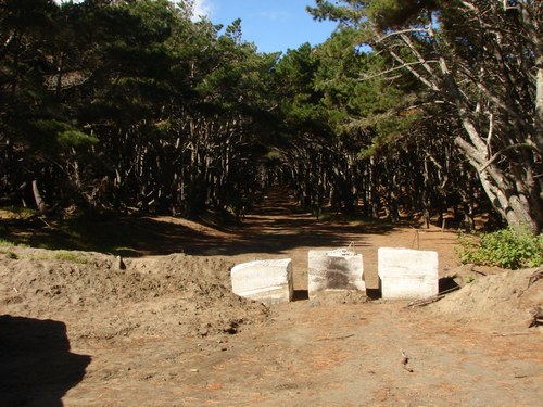
Woodhill DiaryMonday 21 April 2008 page 1 Major Changes at Rimmer's RdWith a few hours to spare but not enough to get to the Waitakeres, Alice and I headed down to Rimmer's Carpark with the intention, my intention, anyhow, of walking south down Coast Rd to Mission Rd and back. We were both minor crocks. Alice sported a large plastic bucket-shaped collar designed to prevent her reaching a wound on her back leg, and I had put my back out in the classic reach behind me and down manoeuvre a day or two earlier. I was pretty much recovered but didn't fancy any great amount of hillwork. No, Rimmers was the story today. First indications that something new was or has been afoot was at the Rimmers Rd/Inland Rd junction. Where previously Inland Rd had continued north to 12 Mile Beach, a great tubular iron gate, locked, and a bunch of huge concrete block barriers barred the way.
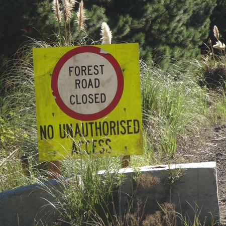
It's well-aged. They must have a shed full of these generic notices somewhere. There's been time for a few weeds to grow around it, but it looks far too shabby to have been purpose made. It's of a kind with most of the CHH signage, to be sure. When did I come down here last? Ages ago. January last year. It had become all rather depressing. Then I recall, the off-road motorcycle park has moved, the one that used to be based at 12 Mile Beach is now back down the road a bit. Hmm. What are the 4WDs using for beach access now that 12 Mile Beach Access is closed? Alice is now fully alert and scanning the road ahead. Forests mean walks. We bump along the gravel road to the Rimmer's carpark, and our questions are answered. (The road is in much better shape than I've seen it at the end of a summer season.) Hullo. What's this? I used to park up by the Coast Rd gate, in the shade. Not any more. I think the concrete firms manufacture these huge blocks out of residue from concrete pours. I'm seeing more and more of them around.
One thing you have to say about CHH - they've got class. Consistent ugliness of this order at their interface with the public does not happen by chance. These guys are naturals, but they work at it, too.
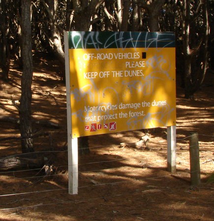
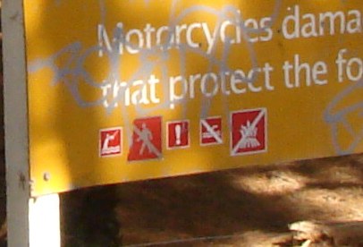
Over where the footpath used to wind through the trees to the beach is another CHH sign with local amendments.
Well, the message is fine, but do I get the impression at the bottom of the sign that pedestrians are banned from this road? Or is that the tagger at work?
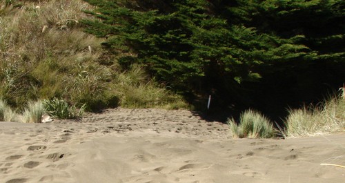
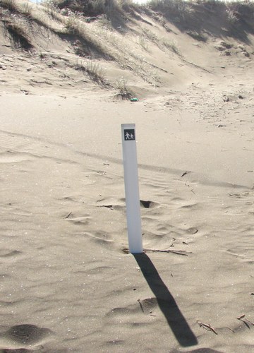
[I take a closer look next time I'm out and there is no doubt pedestrians are forbidden on the original sign. This is not a tagger at work.] Well, maybe it isn't safe to have walkers sharing a 4WD access given the driving habits of some of them. Where's the pedestrian access to the beach, now? I hunt around in vain for alternative access, or signs pointing to, and decide to explore the road anyhow. It's Monday and the traffic is likely to be light or non-existent. A couple of days later, I find the walkway marker. I make no apology for not finding it last time. It was buried in shadow about 50 m up Coast Road beyond the concrete blocks
Anyway, I follow the footprints down the 4WD track. Anybody who thinks that a miniscule picture of a pedestrian with a line through him on the bottom corner of a sign that has been wasted by taggers is going to send pedestrians on a 300m - 400m detour when they can walk 150 metres down the "road" to the beach has got to be crazy.
There's been some money spent on fencing, especially where motor-cycles had previously worn a circuit.
and here's another gate, and another welcoming sign
Reminds me of those little establishments I came across in England in the 1960s that used to take brand new furniture and artificially "antique" it. I wonder if CHH has a special department that works on their signage to make it tatty. We carry on.
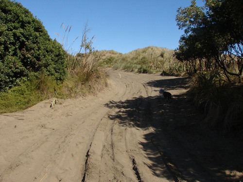
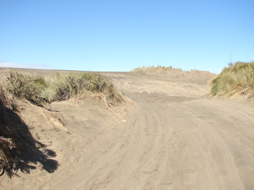
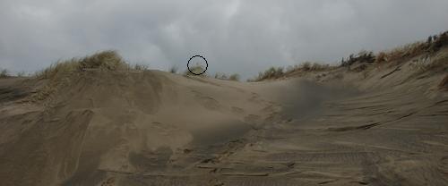
Now this is where it looks like someone has been doing some useful thinking. Instead of taking the vehicle access in a straight line out to the beach, they've built in a big curve to prevent unwanted wind scour. The result, over to the left is a large inner dune, but I suspect the curve has achieved its purpose.
We head round the corner to the beach, and Alice goes bananas. If she could run in four directions simultaneously, she would.
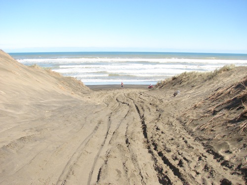
We head south for a hundred metres or so. It's wonderful. What a day to be out.
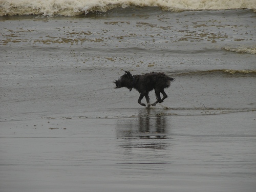
Alice tries drinking salt water, and races a big wave up the beach.
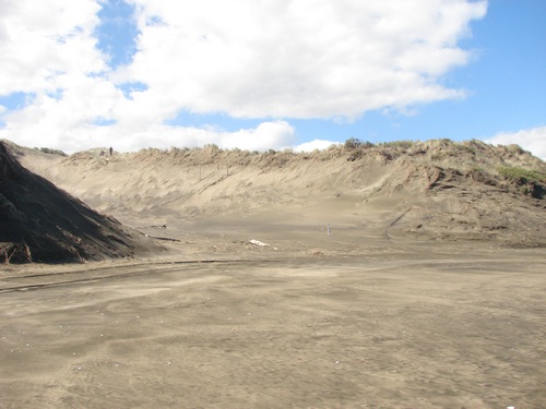
I make for the big gut that used to provide unofficial horse access to the beach from the Coast road. You can get a sense of the scale from the two people up on top. It's quite possible that this gut began as a tyre track from an off-road bike breaking through surface plant cover. The dunes are immensely fragile, and the westerlies that at times blow here are powerful and totally unforgiving.
(Even on something as relatively tough as kikuyu, bikes are bad news out here. Later, I narrowly miss being run over by an idiot, who should never have been anywhere near me, and a few yards further on you can see where he's been. Translated onto the far more fragile dune grasses closer to the beach, that's a gut waiting to happen.)
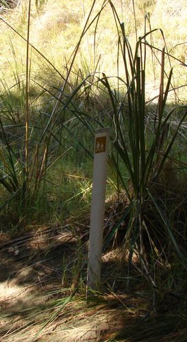
Well, I'll be damned. An old track marker of the kind that used to mark the walking tracks at Woodhill, a little further south. It's not immediately obvious from the beach, but it's the first sign that CHH, or somebody, is even thinking about walkers.
[When I come back a day or two later, someone has placed another pedestrian marker pole out near the entrance to the gut.] We head on up the gut to the top. We discover later that somewhere about here the walking track, such as it is, takes off to the left and skirts the big dune just in front, but it's not obvious. We head up and over.
(It's not obvious because it is in fact not obvious, as I discover on my return visit
Down the other side
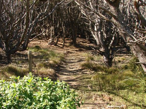
At this point, we can see plain indications of a walking track along the back of the dunes. The green signs, which greeted us on the way up the gut, head north, and we turn south to be greeted by orange walking track signs.
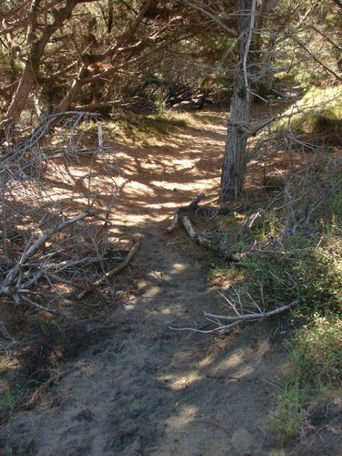
We continue on what proves to be the old horse access route. I suspect it continues to function as such, though there are several other horse access points down the beach further. Track maintenance appears to be more or less consistent with the minimalist standards adopted for the re-opened Woodhill walking tracks further south.
We head south a little way, parallel to the beach, before heading back into the forest.
where it opens up into one of those idyllic moments where everything combines in a shiver of "rightness". Pine needles are thick underfoot, and the recent rain has taken out of the air the fine resinous dust that greeted you in the pines a few weeks back, but somehow the fragrance remains without the tickle.
Just up ahead is Coast Rd and the orange track markers head north, back towards the carpark. So that's where this track starts. Hmmm. When I return to the carpark with this new clue, I still seek in vain for any signage directing walkers to the "new" track. Work in progress? Reminds me of an old NLP adage from Richard Bandler: "There's no such thing as unfinished business - just business that didn't finish the way you wanted."
|
|


 )
) 

 )
)